


Nearmap today announced a national survey program providing true, high-resolution oblique imagery and derivative 3-D products.
Nearmap is already a global leader in providing cloud-based subscription access to up-to-date 2-D orthomosaic aerial imagery. Using its patented HyperCamera2 technology, Nearmap is revolutionizing the oblique aerial imagery market with the same access model.
Because this new camera system provides a high degree of overlap from different angles, Nearmap can reconstruct the real world in stunning detail, producing not only high-resolution orthomosaic and oblique imagery, but also surface and terrain models, natural color point clouds and textured 3-D meshes.
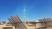
Soon, users can immerse themselves in 3-D textured mesh models, improving analysis and design activities. They can see different elevations and line of sight using the 3-D information. These features become important in many use cases, including airport or utility planning, or to determine the best location for a crane before a construction project. Other applications include wireless telecommunications network modeling, solar panel design, tactical resource deployment, real estate development promotion, property valuation, insurance underwriting and smart cities.
Commencing in April 2017, Nearmap has already surveyed oblique images in Las Vegas; Indianapolis; Austin, Texas; Omaha, Neb.; Phoenix; Seattle; Denver; Kansas City, Kan.; Chicago and New York, and continues to add new areas. By the end of 2017, Nearmap plans to complete surveying the largest urban areas covering more than half of the US populationâ€"about 150 million people.
Nearmap imagery will be refreshed up to three times per year in these coverage areas â€" with three orthomosaic captures incorporating one oblique capture. Nearmap´s orthomosaic imagery already covers nearly 70 percent of the US population dating back to 2014.Â
Nearmap´s oblique imagery can be accessed in the MapBrowser interface or integrated into a customer´s own web application using Nearmap´s industry standard API. Digital surface modeling is also available for export into GIS / CAD tools, including Esri´s ArcGIS Pro. Nearmap will soon enable similar access to the 3-D products.
Nearmap will be showcasing its latest 3-D imagery at the Esri User Conference in San Diego, 10-14 July 1 in booth 2227.